Estimation of soil water erosion based on RUSLE, GIS and remote sensing
Article Sidebar
Main Article Content
Abstract
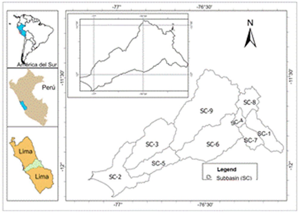
Soil degradation is the main ecological challenge in hydrographic units, as it leads to a decrease in soil fertility. Climate change and anthropogenic factors exacerbate this problem. Based on this, the purpose of this research was to estimate soil loss due to water erosion in the Rímac River basin. To this end, various tools were used, such as remote sensing (RS), Geographic Information Systems (GIS), and the Revised Universal Soil Loss Equation (RUSLE). The findings revealed that the basin has an annual soil loss of 135 t ha-1 year-1. A classification of water erosion was proposed in which 15.30%, 50.43%, and 34.27% of the area are classified as high, medium, and low priority, respectively. By integrating the RUSLE model with GIS and remote sensing, it was possible to accurately calculate and locate soil erosion caused by water, identifying the most urgent intervention areas and thus strengthening decision-making for the sustainable management of soil resources.
Article Details

This work is licensed under a Creative Commons Attribution-NonCommercial 4.0 International License.
Those authors that have publications with this journal accept the following terms:
1. They will retain their copyright and guarantee the journal the right of first publication of their work, which will be simultaneously subject to the License Creative Commons Attribution-NonCommercial 4.0 International (CC BY-NC 4.0) that allows third parties to share the work whenever its author is indicated and its first publication this journal. Under this license the author will be free of:
• Share — copy and redistribute the material in any medium or format
• Adapt — remix, transform, and build upon the material
• The licensor cannot revoke these freedoms as long as you follow the license terms.
Under the following terms:
• Attribution — You must give appropriate credit, provide a link to the license, and indicate if changes were made. You may do so in any reasonable manner, but not in any way that suggests the licensor endorses you or your use.
• NonCommercial — You may not use the material for commercial purposes.
• No additional restrictions — You may not apply legal terms or technological measures that legally restrict others from doing anything the license permits.
2. The authors may adopt other non-exclusive license agreements to distribute the published version of the work (e.g., deposit it in an institutional telematics file or publish it in a monographic volume) whenever the initial publication is indicated in this journal.
3. The authors are allowed and recommended disseminating their work through the Internet (e.g. in institutional telematics archives or on their website) before and during the submission process, which can produce interesting exchanges and increase the citations of the published work. (See the Effect of open access).
References
ALÍ, A.A.; AL-ABBADI, A.M.; JABBAR, F.K.; ALZAHRANI, H.; HAMAD, S.: “Predicción de la tasa de erosión del suelo en subcuencas transfronterizas en Ali Al-Gharbi, sur de Irak, utilizando el modelo GIS basado en RUSLE”, Sustainability, 15(3): 1776., 2023, DOI: https://doi.org/10.3390/su15031776.
EFTHIMIOU, N.; PSOMIADIS, E.; PANAGOS, P.: “Fire severity and soil erosion susceptibility mapping using multi-temporal Earth Observation data: The case of Mati fatal wildfire in Eastern Attica, Greece”, Catena, 187: 104320, 2020, ISSN: 0341-8162, DOI: https://doi.org/10.1016/j.catena.2019.104320.
GHOSH, A.; RAKSHIT, S.; TIKLE, S.; DAS, S.; CHATTERJEE, U.; PANDE, C.; MATTAR, M.: “Integration of GIS and remote sensing with RUSLE model for estimation of soil erosion.”, Land, 12(1): 116, 2022, DOI: https://doi.org/10.3390/land12010116.
GITIMA, G.; TESHOME, M.; KASSIE, M.; JAKUBUS, M.: “Quantifying the impacts of spatiotemporal land use and land cover changes on soil loss across agroecologies and slope categories using GIS and RUSLE model in Zoa watershed, southwest Ethiopia”, Ecological Processes, 12(1): 24, 2023, ISSN: 2192-1709, DOI: https://doi.org/10.1186/s13717-023-00436-x.
MCKAGUE, K.: “Loss Equation. Ministry of agriculture, food and rural affairs”: Ontario, Canada”, Universal Soil Loss Equation (RUSLE)”. Universal Soil Loss Equation (RUSLE)”., 2023, ISSN: 1198-712X.
NEGESE, A.; FEKADU, E.; GETNET, H.: “Potential soil loss estimation and erosion-prone area prioritization using RUSLE, GIS, and remote sensing in Chereti Watershed, Northeastern Ethiopia”, Air, Soil and Water Research, 14: 1178622120985814, 2021, ISSN: 1178-6221, DOI: https://doi.org/10.1177/11786221209858.
PHINZI, K.; NGETAR, N.S.: “The assessment of water-borne erosion at catchment level using GIS-based RUSLE and remote sensing: A review. International Soil and Water Conservation Research, 7 (1), 27-46”, International Soil and Water Conservation Research, 7(1): 27-46, 2019, DOI: https://doi.org10.1016/j.iswcr.2018.12.002.
RENARD, K.G.: Predicting soil erosion by water: a guide to conservation planning with the Revised Universal Soil Loss Equation (RUSLE), Ed. US Department of Agriculture, Agricultural Research Service, 384 p., 1997, ISBN: 0-16-048938-5.
RENARD, K.G.; FREIMUND, J.R.: “Using monthly precipitation data to estimate the R-factor in the revised USLE”, Journal of hydrology, 157(1-4): 287-306, 1994, ISSN: 0022-1694.
SCHOENEBERGER, P.J.; WYSOCKI, D.A.; BENHAM, E.C.: Field book for describing and sampling soils, Ed. Government Printing Office, Natural Resources Conservation Service, National Soil Survey Center, Lincoln, NE ed., 2012, ISBN: 0-16-091542-2.
UGESE, A.A.; AJIBOYE, J.O.; IBRAHIM, E.S.; GAJERE, E.N.; ITSE, A.; SHABA, H.A.: “Soil loss estimation using remote sensing and RUSLE model in Koromi-Federe catchment area of Jos-East LGA, Plateau State, Nigeria”, Geomatics, 2(4): 499-517, 2022, ISSN: 2673-7418.